Why this blog?
Until this moment I have been forced to listen while media and politicians alike have told me "what Canadians think". In all that time they never once asked.
This is just the voice of an ordinary Canadian yelling back at the radio -
"You don't speak for me."
email Kate
Goes to a private
mailserver in Europe.
I can't answer or use every tip, but all are appreciated!


Katewerk Art
Support SDA
Paypal:
Etransfers:
katewerk(at)sasktel.net
Not a registered charity.
I cannot issue tax receipts
Favourites/Resources
Instapundit
The Federalist
Powerline Blog
Babylon Bee
American Thinker
Legal Insurrection
Mark Steyn
American Greatness
Google Newspaper Archive
Pipeline Online
David Thompson
Podcasts
Steve Bannon's War Room
Scott Adams
Dark Horse
Michael Malice
Timcast
@Social
@Andy Ngo
@Cernovich
@Jack Posobeic
@IanMilesCheong
@AlinaChan
@YuriDeigin
@GlenGreenwald
@MattTaibbi
Support Our Advertisers

Sweetwater

Don't Run

Polar Bear Evolution

Email the Author
Wind Rain Temp
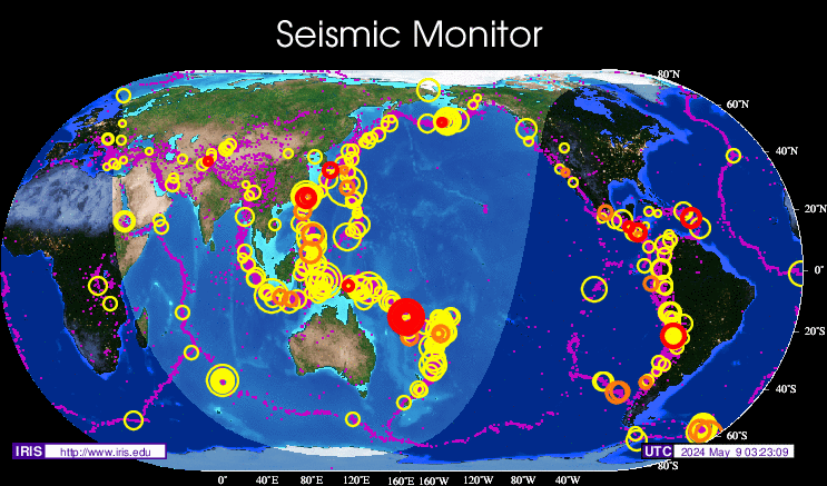
Seismic Map
What They Say About SDA
"Smalldeadanimals doesn't speak for the people of Saskatchewan" - Former Sask Premier Lorne Calvert
"I got so much traffic after your post my web host asked me to buy a larger traffic allowance." - Dr.Ross McKitrick
Holy hell, woman. When you send someone traffic, you send someone TRAFFIC.My hosting provider thought I was being DDoSed. - Sean McCormick
"The New York Times link to me yesterday [...] generated one-fifth of the traffic I normally get from a link from Small Dead Animals." - Kathy Shaidle
"You may be a nasty right winger, but you're not nasty all the time!" - Warren Kinsella
"Go back to collecting your welfare livelihood." - Michael E. Zilkowsky

“Thee? Cawbon taktheth wowk. That’th why I have to thcwew Canada by making peopwe pay mowe.”
I thcwew Canadath twiceth ecauseth itth goesth toth otherth countriesth orth sometimesth mythe Swissth ankth accounth.
With every other country warming twice as fast as every other country somebody’s got to bring down the average.
“somebody’s got to bring down the average.”
You would think so, but that’s not how they think.
An other interesting climate change factoid:
As of September this year area burned by forest fires (obviously directly driven by climate change in California!) are DOWN 92% below a ten year average in Canada.
But that can’t be true! Hadn’t all the arctic ice melted by 2012? Why, haven’t there been literally hundreds of polar circumnavigations in the last 8 years? No? But Al Gore…
Uff da! There goes the narrative!
And precisely why Norse wheat expert, Bjorn was sold into slavery not long after his settlement proposal.
Snow and lot’s of it. Which brings to mind why exactly I had to fly over Iceland on a flight from Munich to Toronto…but I’m sure there’s a perfectly good explanation for it.
If you look at a globe instead of a map, you will find that a straight line between Munich and Toronto goes over Iceland,
Sorry Rusty, I just looked. That ain’t a straight line.
No, it doesn’t.
https://www.greatcirclemap.com/?routes=MUC-YYZ
If you are going non-stop to Victoria, however, it would.
There is – you had to see all that global warming for yourself, otherwise you might not believe it – and then they’d have to shun you for a Denier.
{ – Actually, two good reasons – believe it or not, if you look at a real map, the one that doesn’t show Greenland bigger than South America, the straight-line course from Munich to Toronto over the “round” Earth is pretty close to going over Iceland anyway – http://www.gcmap.com/mapui?P=MUC-YYZ – also, the west – east winds in the Northern Hemisphere are mostly south of Iceland so you’d likely burn less fuel on the route. Routing over the Atlantic is very complex, each NAT track is optimised for wind and other traffic, and the winds change continually so the NAT tracks do too – https://aerosavvy.com/north-atlantic-tracks/ – and each NAT track usually has a transatlantic passenger flight every five minutes. VERY complex airspace, two jumbo jets colliding in mid-air over the middle of the Atlantic doesn’t bear thinking about, and fortunately thanks to a highly developed Air Traffic Control regime, very few passenger-carrying airliners have ever collided in mid-air. So yeah, ATC preventing planes running into each other, is a pretty good explanation – but the other one is funnier. 😉 – }
“Sorry Rusty, I just looked. That ain’t a straight line.”
burton, it all depends on where you’re looking from. Map projections are a weird subject, born of trying to print a round object (the Earth) on a piece of flat paper (the map) accurately enough that you can then use the map to navigate over the face of the Earth in real-life. The problem is that accurate map projections change with latitude – and the distortion gets worse the farther away you are from the equator – so what you end-up having to do, is use different projections based-on the location you are working in.
The standard map that everybody always looks-at when drawing the Earth, is a Mercator Projection based-on the equator – like taking an almost-transparent globe with a light in it, wrapping a cylinder of paper around it, then turning the light on and drawing whatever you see shining off of the globe, onto the paper. This will be bang-on accurate at the equator, but will become distorted the farther north and south you go – and if you wanted to use that projection in the Arctic or Antarctic, you can’t because the cylinder of paper doesn’t get any detail at all from the polar regions. Even by 40° north you’re looking at significant distortion.
You can also tilt your cylinder of paper; you don’t have to centre it on the Equator. Just for the hang of it, let’s say you want to go from oh, Munich to Toronto. So you tilt the cylinder of paper ‘WAAAY off-axis, until your two points “Munich” and “Toronto” are on the cylinder. You can even make your map marginally more useful, by choosing two “reference” “parallels” 10° (600 nautical miles) either side of your course, then tightening your cylinder a bit until it emerges from the Earth along your two “parallels”. Your map is going to look really, really strange – but it will be an extremely accurate projection of your direct course, and will be quite useable for navigating anywhere within about 1000 miles away from it. But you’ll notice that, as you follow your course along the line (which will be perfectly straight – that was the whole point of drawing this projection in the first place) that because of how far you had to tilt the cylinder to get those two points “Munich” and “Toronto” onto the centre of the paper, your course now goes over Iceland.
This becomes more clear if you imagine you are directly over the North Pole, looking down. The meridians of longitude splay-out under you like a spiderweb, and any straight line you draw across that mess will cut-across them at constantly changing angles. Now imagine drawing all those meridians parallel to each other, as in a Mercator Projection – your course will curve across the resulting map, but it is, nonetheless, a straight line across the actual Earth. Ahh, the magic of perspective…
Further to this, look at the map shown in my upper link: http://www.gcmap.com/mapui?P=MUC-YYZ – it looks from this map that the route is steeply curved, and passes a long way south of Iceland. But look at how badly Greenland is distorted – this map shows it to be bigger than North America!
This is likely a Mercator Projection centered a long way south; you can see that the far north and the North Pole would be monstrously distorted – and you can imagine that because of the distortion, Iceland will look to be a lot further north of your course than it actually is. Whereas, if you were directly over your course looking down, it would be straight – and Iceland would be a lot closer. Throw-in some stiff winds to the south, and it would be more economical to route over Iceland to avoid them.
Y. Knott, Thank you, I’ve always had a passion for maps, but don’t have any scholastic knowledge about them. Your three posts were most interesting and informative, and they did answer a number of thoughts that rattle around the open space between my ears. I’m impressed.
On a side note, I have traveled to just about every area of the planet by ship and plane, except for the colder areas. On a mid Summer flight from Vancouver to Tokyo, about ten years ago, we flew just south of Alaska, and even then, it was ninety five percent icy white.
Yet I often wondered why the flight was not more direct A to B, and your summation about earth curve, winds, and fuel management, makes a lot of sense.
In 1965, I flew from Luxembourg to New York with a stop-over in Reykjavik. No shortage of ice then, as I recall, although it was warmer than I had expected. That was on Loftleider (sp?) later to become Icelandic Airways. In-air time was 13 hours in a Bristol Britannia. It was quite an experience for a young adventurer. It took my last $99.
Emerites Air – Dubai to LA – goes straight over the Arctic. I can watch it fly over Sundre going to and from LA.
Maybe the Icelanders should wake up more of their volcanoes.
Perhaps that explains the persistent ice in central Greenland where this past summer I periodically checked out the temperatures on Ventusky and not once did I see any readings close to being above zero Celsius.
This also news that will never be seen or heard on the CBC or its institutionally leftist clones.
Yep – turn that gaslight up to 11!
The GWAlarmists are forever wailing-on “The Antarctic is warming three-times faster than everywhere else! And it’s gonna’ melt all the ice, and we’re ALL GONNA’ DIE!!!” Most of the Antarctic has literally never – not once – had temperatures above zero-degrees Celsius (32 Fahrenheit for old f@rts like me) the whole time we’ve been measuring it – and most of the Antarctic has literally set a new yearly snow-accumulation record every year, for the whole time we’ve been measuring it; 28-years-in-a-row was the last number I saw. I read recently on Wattsupwiththat there are shallow snow depressions around the South Pole that, on windless Winter nights, sink to a lower temperature than scientists (“real” scientists no less) thought was possible on Earth; they were talking >100 degrees below Zero Celsius.
So with almost the entire Antarctic mainland NEVER going above melting temperature, how’s the ice there gonna’ melt? And even if it was “warming three-times-faster than everywhere else”, if that warming still doesn’t take it over melting temperature, it still won’t melt. “YES IT WILL!!!” No it won’t.
But there is an area of Antarctica that is indeed melting – or at least, an area real close to Antarctica; the Western Peninsula is, if the ice all melted so you could see it, actually not connected to Antarctica – it’s an island. The ice is indeed melting there – something to do with the rift fault and the 60-plus active volcanoes under the ice, I reckon.
Ahh, what do I know anyway? 😉
Ventusky is a great app. You can check in seconds the accuracy of the ranting of the green loons when they claim it’s tropical in Greenland.
This series of videos is so interesting; this one talks about the disappearance of the Norse settlements in Greenland after the climate became too cold.
https://www.youtube.com/watch?v=lmbY-GrM8pI
If I was a conspiracy theorist I’d say our “betters” are up to no good.
Extreme Weather! The warming is causing cooling!
Right?